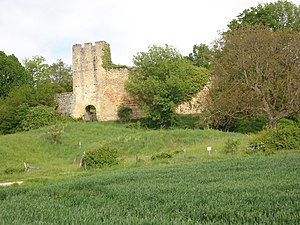
Montchenu
Ilme
commune in Drôme, France
üksikjuht nähtusest
ametlik nimi
Montchenu[4]
riik
asub haldusüksuse territooriumil
canton of Saint-Donat-sur-l'Herbasse
arrondissement of Valence
located in statistical territorial entity
Q108921725
associated electoral district
koordinaadid
valitsusjuhi ametikoht
Mayor of Montchenu
rahvaarv
meessoost elanikkond
naissoost elanikkond
naaberüksused
Bathernay
Charmes-sur-l'Herbasse
Crépol
Saint-Christophe-et-le-Laris
Tersanne
pindala
16,15 ruutkilomeeter[6]
sihtnumber
26350[9]
telefoninumber
+33-4-75-45-63-59[10]
email address
koduleht
Commonsi kategooria
Montchenu
category for maps
Category:Maps of Montchenu
Viited
- ↑ Freebase Data Dumps, 28. oktoober 2013
- ↑ GeoNames
- ↑ BnF authorities, 26. august 2015
- ↑ Code officiel géographique, https://www.insee.fr/fr/information/3363419, 6. jaanuar 2019
- ↑ Code officiel géographique, 22. september 2017, https://www.insee.fr/fr/information/2560698
- ↑ 6,0 6,1 répertoire géographique des communes, 26. oktoober 2015
- ↑ Populations légales 2021
- ↑ 8,0 8,1 The National Institute of Statistics and Economic Studies
- ↑ dataset of postal codes in France, 1. oktoober 2018
- ↑ 10,0 10,1 10,2 Annuaire de service-public.fr, 23. september 2023


