
Fail:Ilinden-Preobrazhenie-Krastovden-Rhodope Uprising.PNG

Selle eelvaate suurus: 482 × 599 pikslit. Teised eraldusvõimed: 193 × 240 pikslit | 386 × 480 pikslit | 750 × 932 pikslit.
Algfail (750 × 932 pikslit, faili suurus: 696 KB, MIME tüüp: image/png)
| See fail ja sellest kastist allapoole jääv kirjeldus pärinevad kesksest failivaramust Wikimedia Commons. | Faili lehekülg Commonsis |
Lühikirjeldus
| Kirjeldus |
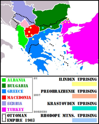
English: A map of the Balkans showing hots spots for uprisings of Ilinden, Preobrazhenie and Krastovden and also insurrectionary actions in Rhodope Mountains, in Macedonia and Thrace regions respectively. |
| Kuupäev | |
| Allikas | Self-made additions to :Image:BlankEurope.png in accordance with "История на България", том 7, Издателство на Българската академия на науките, София, 1991, стр. 496-497 (in Bulgarian; in English: "History of Bulgaria", Volume 7, Publishing house of the Bulgarian Academy of Sciences, Sofia, 1991, pp. 496-497). |
| Autor | Duae Quartunciae, Vulgarian |
Litsents
| Autor Vulgarian inglise Vikipeediast on andnud selle teose avalikku omandisse. See kehtib üleilmselt. Kui see pole mõnes riigis õiguslikult võimalik: Vulgarian annab kõigile õiguse seda teost kasutada ükskõik mille jaoks, ilma ühegi tingimuseta, kui seadus neid just ei sea. |
Esialgne üleslaadimislogi
Projektist en.wikipedia Commonsisse teisaldanud Ggia tööriistaga CommonsHelper.
Esialgne kirjelduslehekülg oli siin. Kõik järgmised kasutajanimed viitavad projektile en.wikipedia.
- 2007-10-01 15:29 Vulgarian 399×496× (21594 bytes) {{Information |Description=A map of the Balkans showing hots spots for uprisings of Ilinden, Preobrazhenie and Krastovden and also insurrectionary actions in Rhodope Mountains, in Macedonia and Thrace regions respectively. |Source=self-made additions to [
- 2007-10-01 15:25 Vulgarian 399×496× (21818 bytes) {{Information |Description=A map of the Balkans showing hots spots for uprisings of Ilinden, Preobrazhenie and Krastovden and also insurrectionary actions in Rhodope Mountains, in Macedonia and Thrace regions respectively. |Source=self-made additions to [
- 2007-10-01 15:14 Vulgarian 399×496× (21820 bytes) {{Information |Description=A map of the Balkans showing hots spots for uprisings of Ilinden, Preobrazhenie and Krastovden and also insurrectionary actions in Rhodope Mountains, in Macedonia and Thrace regions respectively. |Source=self-made additions to [
Faili ajalugu
Klõpsa kuupäeva ja kellaaega, et näha sel ajahetkel kasutusel olnud failiversiooni.
| Kuupäev/kellaaeg | Pisipilt | Mõõtmed | Kasutaja | Kommentaar | |
|---|---|---|---|---|---|
| viimane | 1. oktoober 2022, kell 10:51 | | 750 × 932 (696 KB) | Jingiby | Rv. not an improvement. There was not Albanian state at that time too. Neither the territory of Serbia, nor these of Bulgaria or Greece were the same. |
| 28. september 2022, kell 16:57 |  | 750 × 932 (671 KB) | Sadko | more in line with NPOV and the fact that there was no such independent** territory in the early 20th century | |
| 23. august 2018, kell 11:45 |  | 750 × 932 (696 KB) | Jingiby | Kosovo added. | |
| 20. aprill 2017, kell 21:35 |  | 399 × 496 (16 KB) | Julieta39 | Serbia lighter | |
| 21. detsember 2011, kell 18:55 |  | 399 × 496 (21 KB) | OgreBot | (BOT): Reverting to most recent version before archival | |
| 21. detsember 2011, kell 18:55 |  | 399 × 496 (21 KB) | OgreBot | (BOT): Uploading old version of file from en.wikipedia; originally uploaded on 2007-10-01 15:25:48 by Vulgarian | |
| 21. detsember 2011, kell 18:55 |  | 399 × 496 (21 KB) | OgreBot | (BOT): Uploading old version of file from en.wikipedia; originally uploaded on 2007-10-01 15:14:25 by Vulgarian | |
| 10. september 2011, kell 10:18 |  | 399 × 496 (21 KB) | File Upload Bot (Magnus Manske) | {{BotMoveToCommons|en.wikipedia|year={{subst:CURRENTYEAR}}|month={{subst:CURRENTMONTHNAME}}|day={{subst:CURRENTDAY}}}} {{Information |Description={{en|A map of the Balkans showing hots spots for uprisings of Ilinden, Preobrazhenie and Krastovden and also |
Faili kasutus
Seda faili kasutab järgmine lehekülg:
Globaalne failikasutus
Järgmised muud vikid kasutavad seda faili:
- Faili kasutus vikis ar.wikipedia.org
- Faili kasutus vikis be.wikipedia.org
- Faili kasutus vikis bs.wikipedia.org
- Faili kasutus vikis ceb.wikipedia.org
- Faili kasutus vikis cs.wikipedia.org
- Faili kasutus vikis da.wikipedia.org
- Faili kasutus vikis en.wikipedia.org
- Faili kasutus vikis es.wikipedia.org
- Faili kasutus vikis eu.wikipedia.org
- Faili kasutus vikis fi.wikipedia.org
- Faili kasutus vikis fr.wikipedia.org
- Faili kasutus vikis he.wikipedia.org
- Faili kasutus vikis hy.wikipedia.org
- Faili kasutus vikis it.wikipedia.org
- Faili kasutus vikis ka.wikipedia.org
- Faili kasutus vikis lt.wikipedia.org
- Faili kasutus vikis lv.wikipedia.org
- Faili kasutus vikis mk.wikipedia.org
- Faili kasutus vikis mt.wikipedia.org
- Faili kasutus vikis nl.wikipedia.org
- Faili kasutus vikis ro.wikipedia.org
- Faili kasutus vikis sh.wikipedia.org
- Faili kasutus vikis simple.wikipedia.org
- Faili kasutus vikis sl.wikipedia.org
- Faili kasutus vikis sq.wikipedia.org
- Faili kasutus vikis sv.wikipedia.org
- Faili kasutus vikis tr.wikipedia.org
- Faili kasutus vikis tt.wikipedia.org
- Faili kasutus vikis uk.wikipedia.org
- Faili kasutus vikis vi.wikipedia.org