
Fail:Glasgowcouncil.PNG

Selle eelvaate suurus: 480 × 599 pikslit. Teised eraldusvõimed: 192 × 240 pikslit | 384 × 480 pikslit | 615 × 768 pikslit | 820 × 1024 pikslit | 1641 × 2048 pikslit | 2733 × 3411 pikslit.
Algfail (2733 × 3411 pikslit, faili suurus: 207 KB, MIME tüüp: image/png)
| See fail ja sellest kastist allapoole jääv kirjeldus pärinevad kesksest failivaramust Wikimedia Commons. | Faili lehekülg Commonsis |
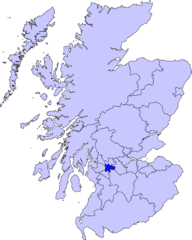
| Kirjeldus | map of Glasgow area | ||||||||
| Kuupäev | |||||||||
| Allikas |
Barryob autoriõiguse omanikuna avaldab selle teose järgmise litsentsi all:
|
||||||||
| Autor | User:Barryob |

Faili ajalugu
Klõpsa kuupäeva ja kellaaega, et näha sel ajahetkel kasutusel olnud failiversiooni.
| Kuupäev/kellaaeg | Pisipilt | Mõõtmed | Kasutaja | Kommentaar | |
|---|---|---|---|---|---|
| viimane | 10. aprill 2007, kell 07:53 | | 2733 × 3411 (207 KB) | Barryob | |
| 9. aprill 2007, kell 00:43 |  | 2733 × 3411 (208 KB) | Barryob | ||
| 31. märts 2007, kell 05:02 |  | 2733 × 3411 (208 KB) | Barryob | {{Information |Description=map of Scottish Parliament Constituency |Source={{GFDL-user|Barryob}} |Date=2006-03-31 |Author=User:Barryob |Permission= |other_versions= }} Category:Maps of unitary councils of Scotland |
Faili kasutus
Seda faili ei kasuta ükski lehekülg.
Globaalne failikasutus
Järgmised muud vikid kasutavad seda faili:
- Faili kasutus vikis af.wikipedia.org
- Faili kasutus vikis arz.wikipedia.org
- Faili kasutus vikis eu.wikipedia.org
- Glasgow
- Lankide:Euskaldunaa
- Txantiloi:Glasgow
- Wikiproiektu:Irlanda, Gales eta Eskoziako udalerriak
- Muirend
- Millerston
- Auchenshuggle
- Baillieston
- Barlanark
- Anderston
- Anniesland
- Arden (Glasgow)
- Athletes' Village (Glasgow 2014)
- Auldhouse
- Balmuildy
- Balornock
- Barmulloch
- Barrachnie
- Barrowfield
- Battlefield (Glasgow)
- Bellahouston
- Blackhill (Glasgow)
- Braidfauld
- Bridgeton (Glasgow)
- Blairdardie
- Blochairn
- Blythswood Hill
- Broomhill (Glasgow)
- Broomhouse (Glasgow)
- Budhill
- Cadder (Glasgow)
- Calton (Glasgow)
- Camlachie
- Cardonald
- Carmyle
- Carmunnock
- Carntyne
- Craigend (Glasgow)
- Carnwadric
- Castlemilk
- Cathcart
- Cessnock (Glasgow)
- Charing Cross (Glasgow)
- Colston
- Corkerhill
- Cowcaddens
- Cowglen
- Cowlairs
Vaata selle faili globaalset kasutust.