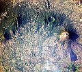
Fail:Volcanoes near Usulután, El Salvador.jpg

Selle eelvaate suurus: 687 × 600 pikslit. Teised eraldusvõimed: 275 × 240 pikslit | 550 × 480 pikslit | 880 × 768 pikslit | 1173 × 1024 pikslit | 2346 × 2048 pikslit | 4037 × 3525 pikslit.
Algfail (4037 × 3525 pikslit, faili suurus: 6,59 MB, MIME tüüp: image/jpeg)
Faili ajalugu
Klõpsa kuupäeva ja kellaaega, et näha sel ajahetkel kasutusel olnud failiversiooni.
| Kuupäev/kellaaeg | Pisipilt | Mõõtmed | Kasutaja | Kommentaar | |
|---|---|---|---|---|---|
| viimane | 26. aprill 2010, kell 14:10 |  | 4037 × 3525 (6,59 MB) | Originalwana | {{Information |Description={{en|1=This astronaut photograph includes four stratovolcanoes—a type of volcano common in active subduction zones—in El Salvador, near the midpoint of the Central American Volcanic Arc. While all o |
Faili kasutus
Seda faili kasutab järgmine lehekülg:
Globaalne failikasutus
Järgmised muud vikid kasutavad seda faili:
- Faili kasutus vikis en.wikipedia.org
- Faili kasutus vikis incubator.wikimedia.org
- Wn/ppl/Achtu Iswat
- Wn/ppl/Ashan 33 shiwit kimiktijket Monseñor Romero
- User:A R King/NavPanel
- Template:Wn/ppl/NavPanel
- Template:Wn/ppl/OtherNews
- Wn/ppl/Chujchuntal
- Wn/ppl/Ajamat
- Wn/ppl/Tikmati
- Wn/ppl/Tajkwilultal
- Wn/ppl/Ken ijtuk tik Kuskatan
- Wn/ppl/Ken ijtuk iwan takamet wan siwatket
- Wn/ppl/Takat wan pelu kinpalewiat siwapipil pal te atukit
- Wn/ppl/Ken ijtuk tik Canada
- Wn/ppl/Pashaluani
- Wn/ppl/Ken ijtuk iwan tamatilis
- Wn/ppl/Ken ijtuk iwan culturaj
- Wn/ppl/Ken ijtuk iwan ne Nawataketzalis
- Wn/ppl/Ken ijtuk iwan tayektzinchiwalis
- Wn/ppl/Ken ijtuk tik Meshijku
- Wn/ppl/Ken ijtuk tik ESA
- Wn/ppl/Ken ijtuk tik Shiktal
- Wn/ppl/Ken ijtuk tik Tatzinu America
- Wn/ppl/Ken ijtuk tik Ewropa
- Wn/ppl/Ken ijtuk tik AAO
- Wn/ppl/Kujkutu
- Wn/ppl/Techajkawtuk ne 'Tepusnantzin' Margaret Thatcher
- Wn/ppl/Ken ijtuk tik Caribe
- Wn/ppl/Ajawilti
- Wn/ppl/Kwak ne tepet pukkisa, ne weyat shuchikisa
- Wn/ppl/Takwikalistal
- Wn/ppl/AllAgenda
- Wn/ppl/Teishpejpenalis Venezuela 2013
- Wn/ppl/SIDA tik Africa: tupajpakilis ipanpa Malik
- Template:Wn/ppl/Dummy2
- Template:Wn/ppl/Dummy2Backup
- Wn/ppl/Kimiktiat se takapiltzin siwayulu pal kishkwepat takat
- Wn/ppl/Tejemet nusan tikpiat se tutaketzalis
- Wn/ppl/Tikwakan ijinsectoj
- Wn/ppl/Mumulutza Chaparrastike
- Wn/ppl/Mikik ne Chickasawtaketza Emily Johnson Dickerson
- Wp/na/Usulutan
- Faili kasutus vikis it.wikipedia.org
- Faili kasutus vikis mk.wikipedia.org
- Faili kasutus vikis nl.wikipedia.org
- Faili kasutus vikis zh.wikipedia.org


