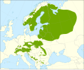
| Allikas |
Caudullo, G., Welk, E., San-Miguel-Ayanz, J., 2017. Chorological maps for the main European woody species. Data in Brief 12, 662-666. DOI: 10.1016/j.dib.2017.05.007
Data: https://doi.org/10.6084/m9.figshare.5110768
References:
- Bartha, D., Csaba, M., 1995. Erdei fa- és cserjefajok előfordulása Magyarországon. Hillebrand Nyomda Kft., Sopron. ISBN 9637180370
- Biodiversity Research Center - Institute of Botany. Flora Database of the Czech Republic. Accessed in September 2016.
- Bohn, U., Gollub, G., Hettwer, C., Weber, H., Neuhäuslová, Z., Raus, T., Schlüter, H., 2000. Karte der natürlichen Vegetation Europas; Map of the Natural Vegetation of Europe. Landwirtschaftsverlag. ISBN 9783784338095
- Boratyński, A., 2007. The Central European disjunctions in the range of Norway Spruce. In: Tjoelker, M. G., Boratynski, A., Bugala, W. (Eds.). Biology and Ecology of Norway Spruce. Forestry Science 78, Springer Netherlands: 37-48. ISBN 9781402048418
- Botanical Society of Britain & Ireland. BSBI big database. Accessed in September 2016.
- Bundesamt für Naturschutz. Floraweb www.floraweb.de (Accessed in September 2016)
- Divíšek, J., Culek, M., 2013. Biogeografie - Multimediální elektronický výukový materiál, 2. vydání. Accessed in September 2016.
- EUFORGEN, 2003. Distribution map of Norway spruce (Picea abies). www.euforgen.org
- European Information System on Forest Genetic Resources. EUFGIS database. (Accessed in September 2016)
- Farjon, A., 2016. Conifer of the world. Online Database, Department of Plant Sciences, University of Oxford. Accessed in September 2016.
- GBIF.org, 2016. Artdata. DOI: 10.15468/dl.vhlsf9
- GBIF.org, 2016. Botanical Society of the British Isles - Vascular Plants Database additions since 2000. DOI: 10.15468/dl.wzy04e
- GBIF.org, 2016. Botanical Society of the British Isles - Vascular Plants Database. DOI: 10.15468/dl.c7xheb
- GBIF.org, 2016. Dutch Vegetation Database (LVD). DOI: 10.15468/dl.km20zh
- GBIF.org, 2016. Fieldjournal.org observation database. DOI: 10.15468/dl.qfbdxi
- GBIF.org, 2016. FloVegSI - Floristical and fitocenological database of ZRC SAZU. DOI: 10.15468/dl.emozjq
- GBIF.org, 2016. FloraCAT: Banco de datos de los cormófitos de Cataluña. DOI: 10.15468/dl.biuda7
- GBIF.org, 2016. Florabank1 - A grid-based database on vascular plant distribution in the northern part of Belgium (Flanders and the Brussels Capital region). DOI: 10.15468/dl.t9ewq8
- GBIF.org, 2016. Floristic Databases of Mecklenburg-Pomerania - Higher Plants. DOI: 10.15468/dl.ttbnoc
- GBIF.org, 2016. Herbarium of Jyväskylä University Museum. DOI: 10.15468/dl.qlmmfd
- GBIF.org, 2016. INPN - Données flore des CBN agrégées par la FCBN. DOI: 10.15468/dl.gkp7wm
- GBIF.org, 2016. Institute of Dendrology PAS, Flora of Sudety Mountains. DOI: .15468/dl.kybkpr
- GBIF.org, 2016. Karl Franzens University of Graz, Insitute for Botany - Herbarium GZU. DOI: 10.15468/dl.4ok78i
- GBIF.org, 2016. National System of Protected Areas in Poland - Plants. DOI: 10.15468/dl.ym4vmn
- GBIF.org, 2016. Norwegian Species Observation Service. DOI: 10.15468/dl.6domy8
- GBIF.org, 2016. Occurrence Data of Vascular Plants collected or compiled for the Flora of Bavaria. DOI: 10.15468/dl.olxxvo
- GBIF.org, 2016. Sistema de Información de la vegetación Ibérica y Macaronésica. DOI: 10.15468/dl.m8zdd8
- GBIF.org, 2016. University of Vienna, Institute for Botany - Herbarium WU. DOI: 0.15468/dl.x5raqx
- GBIF.org, 2016. Vascular plants in Denmark recorded under the The Nationwide Monitoring and Assessment Programme for the Aquatic and Terrestrial Environments (NOVANA). DOI: 10.15468/dl.hnqokh
- Hultén, E., 1971. Atlas över växternas utbredning i Norden, 2nd edition. Generalstabens litografiska anstalts förlag, Stockholm.
- Jalas, J., Suominen, J., 1973. Atlas Florae Europaeae: distribution of vascular plants in Europe Vol. 2 Gymnospermae (Pinaceae to Ephedraceae). Committee for Mapping the Flora of Europe and Societas Biologica Fennica Vanamo, Helsinki.
- Meusel, H., Jäger, E. J., Weinert, E. (Eds.), 1965. Vergleichende Chorologie der Zentraleuropäischen Flora, Band I. Gustav Fischer Verlag, Jena.
- Nikolić, T. (Ed.), 2015. Flora Croatica Database. Faculty of Science, University of Zagreb. Accessed in September 2016.
- Real Jardín Botánico, CSIC - Fundación Biodiversidad. Anthos - Information System of the plants of Spain. Accessed in September 2016.
- Schuler, A., 2007. Contribution to the flora of northern and central Greece. Willdenowia 37(1), 229-241.
- Tela Botanica. eFlore. Accessed in September 2016.
|


