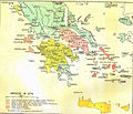
Fail:Greece in 1278.svg

Selle SVG-faili PNG-vormingus eelvaate suurus: 800 × 456 pikslit. Teised eraldusvõimed: 320 × 182 pikslit | 640 × 365 pikslit | 1024 × 584 pikslit | 1280 × 730 pikslit | 2560 × 1460 pikslit | 3508 × 2000 pikslit.
Algfail (SVG-fail, algsuurus 3508 × 2000 pikslit, faili suurus: 1014 KB)
Faili ajalugu
Klõpsa kuupäeva ja kellaaega, et näha sel ajahetkel kasutusel olnud failiversiooni.
| Kuupäev/kellaaeg | Pisipilt | Mõõtmed | Kasutaja | Kommentaar | |
|---|---|---|---|---|---|
| viimane | 23. juuni 2017, kell 23:04 |  | 3508 × 2000 (1014 KB) | Cplakidas | fixed name |
| 11. aprill 2017, kell 15:14 |  | 3508 × 2000 (1017 KB) | Cplakidas | colour changes | |
| 8. veebruar 2017, kell 21:22 |  | 3508 × 2000 (1018 KB) | Cplakidas | text to paths | |
| 8. veebruar 2017, kell 21:11 |  | 3508 × 2000 (1002 KB) | Cplakidas | User created page with UploadWizard |
Faili kasutus
Seda faili kasutavad järgmised 2 lehekülge:
Globaalne failikasutus
Järgmised muud vikid kasutavad seda faili:
- Faili kasutus vikis ar.wikipedia.org
- Faili kasutus vikis az.wikipedia.org
- Faili kasutus vikis bg.wikipedia.org
- Faili kasutus vikis el.wikipedia.org
- Faili kasutus vikis en.wikipedia.org
- Fourth Crusade
- Principality of Achaea
- Patras
- Battle of Halmyros
- History of Thessaly
- John I Doukas of Thessaly
- Nicholas III of Saint-Omer
- Nicholas II of Saint-Omer
- Matilda of Hainaut
- Boniface of Verona
- Battle of Neopatras
- Battle of Demetrias
- Lordship of Salona
- Jacopo Dondulo
- Byzantine–Venetian treaty of 1277
- Faili kasutus vikis es.wikipedia.org
- Faili kasutus vikis fa.wikipedia.org
- Faili kasutus vikis fr.wikipedia.org
- Faili kasutus vikis hr.wikipedia.org
- Faili kasutus vikis hyw.wikipedia.org
- Faili kasutus vikis it.wikipedia.org
- Faili kasutus vikis ka.wikipedia.org
- Faili kasutus vikis pl.wikipedia.org
- Faili kasutus vikis pt.wikipedia.org
- Faili kasutus vikis ru.wikipedia.org
- Faili kasutus vikis sq.wikipedia.org
- Faili kasutus vikis sr.wikipedia.org
- Faili kasutus vikis tr.wikipedia.org
- Faili kasutus vikis uk.wikipedia.org
- Faili kasutus vikis www.wikidata.org
Vaata selle faili globaalset kasutust.


