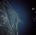
Fail:Cape canaveral.jpg

Selle eelvaate suurus: 606 × 600 pikslit. Teised eraldusvõimed: 242 × 240 pikslit | 485 × 480 pikslit | 776 × 768 pikslit | 1035 × 1024 pikslit | 2069 × 2048 pikslit | 5320 × 5266 pikslit.
Algfail (5320 × 5266 pikslit, faili suurus: 7,79 MB, MIME tüüp: image/jpeg)
Faili ajalugu
Klõpsa kuupäeva ja kellaaega, et näha sel ajahetkel kasutusel olnud failiversiooni.
| Kuupäev/kellaaeg | Pisipilt | Mõõtmed | Kasutaja | Kommentaar | |
|---|---|---|---|---|---|
| viimane | 21. märts 2009, kell 22:35 |  | 5320 × 5266 (7,79 MB) | Jhf | Same image with greater resolution |
| 18. juuni 2005, kell 05:39 |  | 504 × 633 (98 KB) | Charlitos~commonswiki | Cape Canaveral, Florida, USA - August 1991 from: http://en.wikipedia.org/wiki/Image:Cape_canaveral.jpg image description [http://eol.jsc.nasa.gov/sseop/EFS/photoinfo.pl?PHOTO=STS043-84-31 here] {{PD-USGov-NASA}} |
Faili kasutus
Seda faili kasutab järgmine lehekülg:
Globaalne failikasutus
Järgmised muud vikid kasutavad seda faili:
- Faili kasutus vikis af.wikipedia.org
- Faili kasutus vikis ang.wikipedia.org
- Faili kasutus vikis ar.wikipedia.org
- Faili kasutus vikis ast.wikipedia.org
- Faili kasutus vikis az.wikipedia.org
- Faili kasutus vikis be.wikipedia.org
- Faili kasutus vikis bg.wikipedia.org
- Faili kasutus vikis bn.wikipedia.org
- Faili kasutus vikis bs.wikipedia.org
- Faili kasutus vikis ca.wikipedia.org
- Faili kasutus vikis ceb.wikipedia.org
- Faili kasutus vikis ckb.wikipedia.org
- Faili kasutus vikis cs.wikipedia.org
- Faili kasutus vikis da.wikipedia.org
- Faili kasutus vikis de.wikipedia.org
- Faili kasutus vikis de.wikinews.org
- Faili kasutus vikis de.wikivoyage.org
- Faili kasutus vikis el.wikipedia.org
- Faili kasutus vikis en.wikipedia.org
- Faili kasutus vikis en.wikiversity.org
- Faili kasutus vikis eo.wikipedia.org
- Faili kasutus vikis es.wikipedia.org
- Faili kasutus vikis eu.wikipedia.org
- Faili kasutus vikis fa.wikipedia.org
- Faili kasutus vikis fi.wikipedia.org
- Faili kasutus vikis fr.wikipedia.org
- Faili kasutus vikis gl.wikipedia.org
- Faili kasutus vikis he.wikipedia.org
- Faili kasutus vikis he.wikivoyage.org
- Faili kasutus vikis hr.wikipedia.org
- Faili kasutus vikis hu.wikipedia.org
- Faili kasutus vikis hy.wikipedia.org
Vaata selle faili globaalset kasutust.
