
Fail:Baton Rouge Louisiana waterfront aerial view.jpg
Selle eelvaate suurus: 750 × 600 pikslit. Teised eraldusvõimed: 300 × 240 pikslit | 600 × 480 pikslit | 960 × 768 pikslit | 1280 × 1024 pikslit | 1500 × 1200 pikslit.
Algfail (1500 × 1200 pikslit, faili suurus: 1,04 MB, MIME tüüp: image/jpeg)
| See fail ja sellest kastist allapoole jääv kirjeldus pärinevad kesksest failivaramust Wikimedia Commons. | Faili lehekülg Commonsis |
| Kirjeldus |
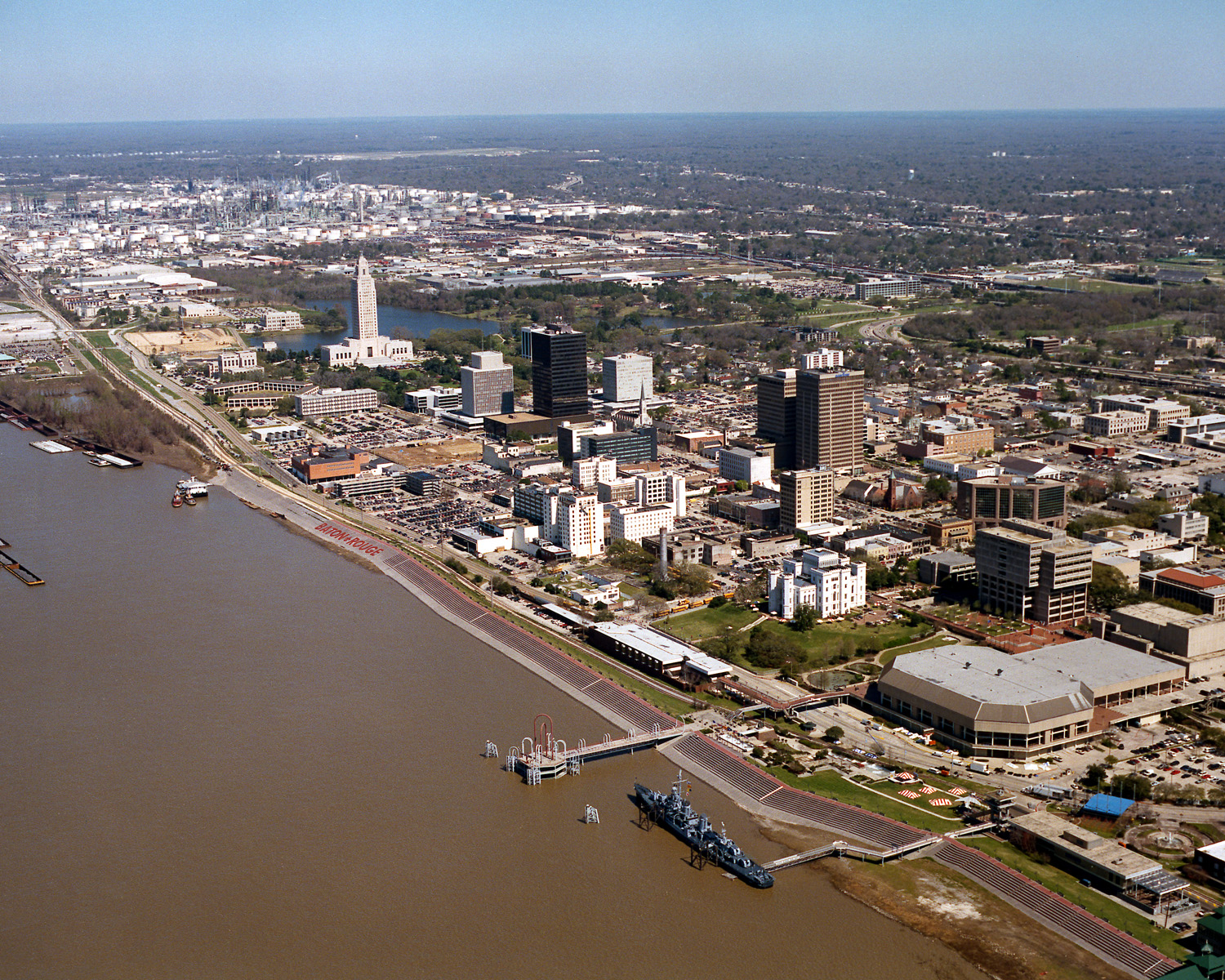
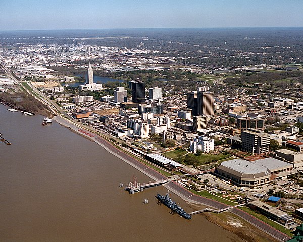
English: Aerial view of the riverfront area of Baton Rouge, Louisiana, USA. The city fronts on the Mississippi River in the center of Louisiana. The tall state capitol tower can be seen at center left. The historic destroyer USS Kidd is moored in the river at the bottom of the picture. View is to the north-northeast. |
|||
| Kuupäev | ||||
| Allikas |
U.S. Army Corps of Engineers Digital Visual Library Image page Image description page Digital Visual Library home page |
|||
| Autor | Michael Maples, U.S. Army Corps of Engineers | |||
| Luba (Faili edasikasutus) |
|
|||
| Asukoht | Baton Rouge, Louisiana, USA |
| Kaamera asukoht | | See ja teised pildid sellest paigast lehel: OpenStreetMap |
|---|
Faili ajalugu
Klõpsa kuupäeva ja kellaaega, et näha sel ajahetkel kasutusel olnud failiversiooni.
| Kuupäev/kellaaeg | Pisipilt | Mõõtmed | Kasutaja | Kommentaar | |
|---|---|---|---|---|---|
| viimane | 6. aprill 2007, kell 06:05 | | 1500 × 1200 (1,04 MB) | DanMS | {{Information | Description = {{en|Aerial view of the riverfront area of Baton Rouge, Louisiana, USA. The ctiy fronts on the Mississippi River in the center of Louisiana. The tall state capital tower can be seen at center left. The historic destroyer U |
Faili kasutus
Seda faili kasutab järgmine lehekülg:
Globaalne failikasutus
Järgmised muud vikid kasutavad seda faili:
- Faili kasutus vikis af.wikipedia.org
- Faili kasutus vikis an.wikipedia.org
- Faili kasutus vikis ar.wikipedia.org
- Faili kasutus vikis arz.wikipedia.org
- Faili kasutus vikis ast.wikipedia.org
- Faili kasutus vikis az.wikipedia.org
- Faili kasutus vikis bat-smg.wikipedia.org
- Faili kasutus vikis be-tarask.wikipedia.org
- Faili kasutus vikis be.wikipedia.org
- Faili kasutus vikis bg.wikipedia.org
- Faili kasutus vikis br.wikipedia.org
- Faili kasutus vikis ca.wikipedia.org
- Faili kasutus vikis ceb.wikipedia.org
- Faili kasutus vikis ce.wikipedia.org
- Faili kasutus vikis cy.wikipedia.org
- Faili kasutus vikis dag.wikipedia.org
- Faili kasutus vikis da.wikipedia.org
- Faili kasutus vikis de.wikipedia.org
- Faili kasutus vikis de.wikivoyage.org
- Faili kasutus vikis diq.wikipedia.org
- Faili kasutus vikis el.wikipedia.org
- Faili kasutus vikis en.wikipedia.org
- Faili kasutus vikis en.wikinews.org
- Faili kasutus vikis en.wikivoyage.org
- Faili kasutus vikis en.wiktionary.org
- Faili kasutus vikis es.wikipedia.org
- Faili kasutus vikis eu.wikipedia.org
- Faili kasutus vikis fi.wikipedia.org
- Faili kasutus vikis fr.wikipedia.org
- Faili kasutus vikis fr.wikivoyage.org
- Faili kasutus vikis fy.wikipedia.org
- Faili kasutus vikis ga.wikipedia.org
- Faili kasutus vikis gl.wikipedia.org
- Faili kasutus vikis he.wikipedia.org
- Faili kasutus vikis he.wikivoyage.org
- Faili kasutus vikis hsb.wikipedia.org
- Faili kasutus vikis ht.wikipedia.org
- Faili kasutus vikis hu.wikipedia.org
Vaata selle faili globaalset kasutust.